Ever stared at a world map and wondered why some countries feel like they belong in two places at once? Or why statisticians argue over whether Cyprus sits in Europe or Asia? I’ve been there—planning a backpacking route through the Caucasus years ago, I got tangled in exactly that debate. The truth is, there’s no single “right” way to slice up the planet, but one system stands out as the gold standard for governments, researchers, and data nerds everywhere: the United Nations geoscheme.
This official listing isn’t about politics or borders drawn on old maps. It’s a practical tool built purely for statistics, updated regularly by the UN Statistics Division through its M49 standard. It covers 248 countries and territories, including every UN member state plus observers and dependencies.
What Makes a Listing “Official”?
Governments and organizations need consistency when comparing populations, trade flows, or climate impacts across borders. Random lists from travel sites or old atlases just don’t cut it. The UN’s version wins because it’s neutral, regularly maintained, and used by everyone from the World Bank to your favorite news app. No hidden agendas—just clean geography for crunching numbers.
The United Nations Geoscheme: The Gold Standard
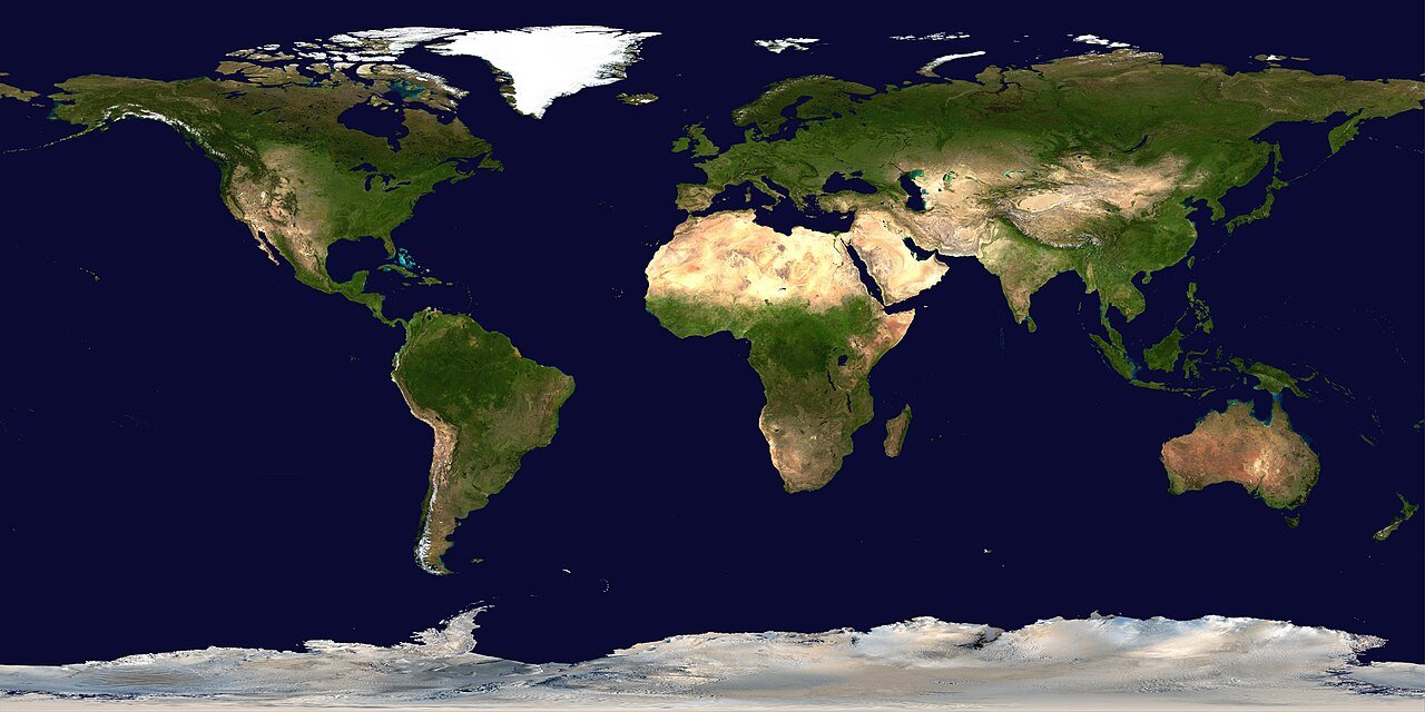
Created in the 1980s and refined over decades, the geoscheme divides the world into five main continental regions (Africa, Americas, Asia, Europe, Oceania) plus Antarctica as a special case. It drills down into 22 subregions and a couple of handy intermediate groups like “Latin America and the Caribbean.” The beauty? Every country or territory gets exactly one home—no double-counting Russia or Turkey. I still smile remembering how this system cleared up a family trivia night argument about Kazakhstan. Turns out the UN keeps things tidy for a reason.
Africa: The Cradle of Humanity and 60 Entries Strong
Africa tops the charts with the most sovereign states—54 UN members alone—plus territories that make the total even richer. Its vast deserts, rainforests, and savannas tell stories of ancient civilizations and modern growth. Whether you’re tracking development aid or planning a safari, this region’s official breakdown helps make sense of it all.
Northern Africa: Where Desert Meets the Mediterranean
Think pyramids, bustling souks, and the gateway between Africa and Europe. This subregion blends Arab culture with ancient history and sits right on the Mediterranean. It’s home to seven areas, including the disputed Western Sahara, and plays a huge role in migration and energy discussions worldwide.
- Algeria
- Egypt
- Libya
- Morocco
- Sudan
- Tunisia
- Western Sahara
Eastern Africa: From Great Lakes to Indian Ocean Islands
Home to wildlife wonders like the Serengeti and the source of the Nile, this area mixes mainland giants with island nations. It’s one of the fastest-growing subregions demographically, which makes its 22 entries essential for any global health or agriculture report. I once watched a sunrise over Mount Kilimanjaro and realized how interconnected these nations really are.
- British Indian Ocean Territory, Burundi, Comoros, Djibouti, Eritrea, Ethiopia, French Southern Territories, Kenya, Madagascar, Malawi, Mauritius, Mayotte, Mozambique, Réunion, Rwanda, Seychelles, Somalia, South Sudan, Uganda, United Republic of Tanzania, Zambia, Zimbabwe
Middle Africa: The Heart of the Congo Basin
Dense rainforests, mighty rivers, and some of the world’s most biodiverse spots define this zone. Nine territories here face unique challenges around resources and stability, yet they hold incredible potential. A quick glance at the list shows why conservationists keep this subregion on speed dial.
- Angola, Cameroon, Central African Republic, Chad, Congo, Democratic Republic of the Congo, Equatorial Guinea, Gabon, Sao Tome and Principe
Southern Africa: Diamonds, Deserts, and Dynamic Economies
From Table Mountain to the Kalahari, this compact group of five punches above its weight in mining and tourism. South Africa leads the pack, but the whole subregion shares deep economic ties. It’s the part of Africa that often surprises first-time visitors with its modern cities and stunning landscapes.
- Botswana, Eswatini, Lesotho, Namibia, South Africa
Western Africa: Vibrant Coastlines and Sahel Savannas
Busy ports, colorful markets, and the legendary Sahara edge make this 17-country stretch unforgettable. Nigeria’s sheer size dominates the stats, but every nation here brings something special to the table—whether it’s Ghana’s stability or Senegal’s culture. I still crave jollof rice just thinking about it.
- Benin, Burkina Faso, Cabo Verde, Côte d’Ivoire, Gambia, Ghana, Guinea, Guinea-Bissau, Liberia, Mali, Mauritania, Niger, Nigeria, Saint Helena, Senegal, Sierra Leone, Togo
The Americas: 57 Territories Spanning Two Hemispheres
The UN cleverly splits the Americas into Northern America and the big intermediate group “Latin America and the Caribbean.” This avoids the old North-vs-South debate and reflects cultural and economic realities far better than a simple line at the Rio Grande.
Latin America and the Caribbean: Tropical Diversity at Its Finest
From Caribbean beaches to Andean peaks, this powerhouse intermediate region covers 52 entries. It’s where Spanish, Portuguese, French, and English cultures mix with Indigenous roots. Economists love this grouping for tracking everything from remittances to hurricane recovery.
Caribbean Subregion
- Anguilla, Antigua and Barbuda, Aruba, Bahamas, Barbados, Bonaire/Sint Eustatius/Saba, British Virgin Islands, Cayman Islands, Cuba, Curaçao, Dominica, Dominican Republic, Grenada, Guadeloupe, Haiti, Jamaica, Martinique, Montserrat, Puerto Rico, Saint Barthélemy, Saint Kitts and Nevis, Saint Lucia, Saint Martin (French), Saint Vincent and the Grenadines, Sint Maarten (Dutch), Trinidad and Tobago, Turks and Caicos Islands, United States Virgin Islands
Central America
- Belize, Costa Rica, El Salvador, Guatemala, Honduras, Mexico, Nicaragua, Panama
South America
- Argentina, Bolivia, Bouvet Island, Brazil, Chile, Colombia, Ecuador, Falkland Islands (Malvinas), French Guiana, Guyana, Paraguay, Peru, South Georgia and South Sandwich Islands, Suriname, Uruguay, Venezuela
Northern America: The High-Income North
Just five main players plus a few territories, but they pack enormous economic punch. Canada and the United States drive global innovation while Greenland and Bermuda add unique flavors. This grouping keeps stats clean when comparing developed economies.
- Bermuda, Canada, Greenland, Saint Pierre and Miquelon, United States of America (Antarctica sometimes referenced here for statistical convenience)
Asia: The World’s Most Populous Continent with 50 Entries
Asia stretches from the Middle East to the Pacific and holds over half the planet’s people. The UN splits it into five logical subregions that respect mountain ranges and cultural zones far better than old colonial maps ever did.
Central Asia: The Silk Road Legacy
Five landlocked nations rich in history and resources. Kazakhstan stands out for its size, while the others share deep ties through the former Soviet era. This subregion matters hugely for energy and Belt-and-Road discussions.
- Kazakhstan, Kyrgyzstan, Tajikistan, Turkmenistan, Uzbekistan
Eastern Asia: Tech Giants and Ancient Traditions
China, Japan, and the Koreas dominate headlines here. Seven entries total, including special administrative regions. This is where economic miracles and demographic shifts play out on the biggest stage.
- China, China Hong Kong SAR, China Macao SAR, Democratic People’s Republic of Korea, Japan, Mongolia, Republic of Korea
South-eastern Asia: ASEAN Powerhouse
Eleven nations from island archipelagos to mainland jungles. Indonesia’s population alone rivals many continents. Travelers and investors alike swear by this grouping for its vibrant mix of cultures and booming economies.
- Brunei Darussalam, Cambodia, Indonesia, Lao People’s Democratic Republic, Malaysia, Myanmar, Philippines, Singapore, Thailand, Timor-Leste, Viet Nam
Southern Asia: The Indian Subcontinent and Neighbors
Nine countries home to over 1.9 billion people. From the Himalayas to tropical beaches, this subregion drives global population and poverty-reduction conversations. India’s scale is mind-blowing even on paper.
- Afghanistan, Bangladesh, Bhutan, India, Iran, Maldives, Nepal, Pakistan, Sri Lanka
Western Asia: Crossroads of Civilizations
Eighteen entries spanning the Arabian Peninsula to the Caucasus. Oil wealth meets ancient history here. Note that Cyprus, Armenia, Azerbaijan, and Georgia sit here statistically—something that still surprises many Europeans I’ve chatted with over coffee.
- Armenia, Azerbaijan, Bahrain, Cyprus, Georgia, Iraq, Israel, Jordan, Kuwait, Lebanon, Oman, Qatar, Saudi Arabia, State of Palestine, Syrian Arab Republic, Türkiye, United Arab Emirates, Yemen
Europe: 51 Sophisticated Entries
Compact yet incredibly diverse, Europe’s four subregions reflect everything from Nordic welfare states to Mediterranean sunshine. The UN keeps Russia firmly in Eastern Europe, which simplifies countless datasets.
Eastern Europe
- Belarus, Bulgaria, Czechia, Hungary, Poland, Republic of Moldova, Romania, Russian Federation, Slovakia, Ukraine
Northern Europe
- Åland Islands, Denmark, Estonia, Faroe Islands, Finland, Guernsey, Iceland, Ireland, Isle of Man, Jersey, Latvia, Lithuania, Norway, Svalbard and Jan Mayen, Sweden, United Kingdom
Southern Europe
- Albania, Andorra, Bosnia and Herzegovina, Croatia, Gibraltar, Greece, Holy See, Italy, Malta, Montenegro, North Macedonia, Portugal, San Marino, Serbia, Slovenia, Spain
Western Europe
- Austria, Belgium, France, Germany, Liechtenstein, Luxembourg, Monaco, Netherlands, Switzerland
Oceania: Island Nations and the Land Down Under
Four subregions capture everything from bustling Australia to tiny Pacific atolls. Fourteen main entries plus territories make this the smallest but perhaps most climate-vulnerable region.
Australia and New Zealand
- Australia, Christmas Island, Cocos (Keeling) Islands, Heard Island and McDonald Islands, New Zealand, Norfolk Island
Melanesia
- Fiji, New Caledonia, Papua New Guinea, Solomon Islands, Vanuatu
Micronesia
- Guam, Kiribati, Marshall Islands, Micronesia (Federated States of), Nauru, Northern Mariana Islands, Palau, United States Minor Outlying Islands
Polynesia
- American Samoa, Cook Islands, French Polynesia, Niue, Pitcairn, Samoa, Tokelau, Tonga, Tuvalu, Wallis and Futuna
Antarctica: The Frozen Continent with Zero Countries
No sovereign states call this icy wilderness home, yet the UN tracks it separately for scientific and environmental data. Research stations from dozens of nations operate here under international treaty. It’s a powerful reminder that some places belong to everyone—and no one.
How Many Countries per Region? Quick Comparison Table
| Region | Sovereign States (approx.) | Total Entries (incl. territories) | Notable Feature |
|---|---|---|---|
| Africa | 54 | 60 | Most countries |
| Americas | 35 | 57 | Split into North & Latin/Caribbean |
| Asia | 49 | 50 | Highest population |
| Europe | 44 | 51 | Most integrated economies |
| Oceania | 14 | 25+ | Most climate-vulnerable |
| Antarctica | 0 | 1 | Science-only zone |
UN Geoscheme vs. Traditional Continents: Key Differences
Many of us grew up with seven continents, but the UN’s system is more practical. It places Cyprus and Georgia in Western Asia, keeps Mexico out of “Northern America,” and treats Latin America as one cohesive block. These choices make statistical apples-to-apples comparisons possible. The old school model is great for school textbooks; the UN version rules real-world data.
Pros and Cons of Relying on the UN Classification
Pros
- Completely neutral and updated regularly
- Perfect for international reports and funding decisions
- Handles territories and disputed areas cleanly
- Widely adopted by governments and NGOs
Cons
- Doesn’t match cultural or political self-identity (Turkey, Russia)
- Some small territories feel overlooked
- Changes slowly when new countries emerge
- Requires explanation for general audiences
People Also Ask About Countries by Region
How many countries are there in each continent?
Africa leads with 54, followed by Asia (49), Europe (44-51 depending on definition), North America (23), South America (12), and Oceania (14). The UN geoscheme gives the most precise counts.
Is the UN list different from the seven-continent model?
Yes—especially for transcontinental countries and the Americas split. It’s designed for statistics, not classroom maps.
Which countries are transcontinental?
Russia, Turkey, Kazakhstan, Azerbaijan, Georgia, and Armenia all straddle Europe and Asia. The UN assigns them based on statistical convenience.
Where can I download the official list?
Straight from the UN Statistics Division M49 page—free Excel and detailed notes included.
Why does Cyprus appear in Asia?
Geographical and statistical reasons. It sits closer to Western Asia and fits better in those datasets.
FAQ: Your Top Questions Answered
What is the most reliable source for countries by region?
The UN M49 standard at unstats.un.org/unsd/methodology/m49 is the gold standard used by virtually every international organization.
Does the list include territories or only sovereign states?
Both. You’ll find 193 UN members plus observers, free-associated states, and dozens of dependencies for complete statistical coverage.
Has the list changed recently?
The core structure is stable since South Sudan’s 2011 independence. Minor updates handle new territories or name changes.
Can I use this for my business or research?
Absolutely. It’s public domain and perfect for market analysis, academic papers, or travel planning.
Where do disputed territories like Kosovo or Taiwan fit?
Kosovo uses a statistical code under Serbia; Taiwan Province of China falls under China per UN resolutions. Footnotes explain the nuances.
Whether you’re a student writing a paper, a traveler mapping your next adventure, or a professional analyzing global trends, this official UN listing cuts through the confusion. It’s not flashy, but it’s accurate, consistent, and trusted worldwide. Next time someone asks “Is Turkey in Europe or Asia?” you’ll have the perfect answer ready—and maybe even impress them with a quick fact about subregions. The world is beautifully complex, and the UN geoscheme helps us make sense of it one data point at a time.